A new data-driven journalism platform launched today to expose environmental threats to South America’s Gran Chaco, a region that suffers from the world’s highest deforestation rate.
A group of researchers, cartographers, developers and journalists created CartoChaco, which uses news stories alongside maps powered by satellite data to reveal the impacts of natural resource exploitation in the region.
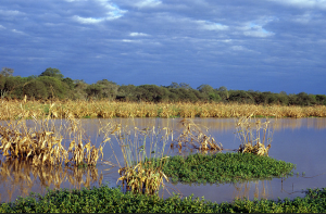
The Gran Chaco Americano, also known as the Chaco Plain, extends through 106 million hectares of wetlands, dry forests and savannas across Paraguay, Argentina, Bolivia and Brazil. It's second only to the Amazon in biodiversity, and like that region, faces many environmental threats, especially deforestation. "In the last decade alone, 2.5 million acres [of the Gran Chaco] have been turned into soybean fields, displacing subsistence farmers and cattle barons alike," writes Christine MacDonald in Rolling Stone. "But while the Amazon has an institutional charity system fighting for its survival, hardly anyone outside of South America has heard of the Chaco."
Enter CartoChaco, which wants to create a community of experts, media and citizens involved in the conservation of the Gran Chaco.
The site's "tools allow you to contextualize and update different actors, including scientists interested in the latest findings in your area of interest, journalists seeking to report their activities related to the environment stories, and the general public interested in what happens in this region," researcher Alejandro Coca Castro, a researcher with the International Centre for Tropical Agriculture (CIAT), said in a release.
Colombia-based CIAT leads the Terra-i project, which monitors deforestation. Terra-i joined with researchers from Paraguay's Guyra Association, journalists and developers from InfoAmazonia, and programmers from IT firm Simgia in Asuncion to create CartoChaco. The site received funding from the Earth Journalism Network, a project of the media development organization Internews, and CIAT.
At launch, CartoChaco presents six interactive maps, which reveal multiple threats to the region. The site also includes 20 geotagged news stories (in Spanish) that look at the trends in the data. It was built using the JEO mapping platform that underpins InfoAmazonia, founded by recent ICFJ Knight International Journalism Fellow Gustavo Faleiros, who is also part of the CartoChaco team.
CartoChaco is the latest in a growing list of projects using JEO to map environmental threats from Indonesia to South Africa.
Global media innovation content related to the projects and partners of the Knight Fellowships on IJNet is supported by the John S. and James L. Knight Foundation and edited by Jennifer Dorroh.
Image from Gran Chaco courtesy of Flickr user Christian Ostrosky with a CC-license.